
- Видео 112
- Просмотров 5 191 529
Rami Tamimi
США
Добавлен 7 июн 2011
Hi there! My name is Rami Tamimi and I am a passionate surveyor and geodetic engineer. With over 10 years of experience in the land development industry, I have a wealth of knowledge to share. That's why I started my own RUclips channel, where I educate others about the surveying and geospatial industry and showcase exciting new technologies. Follow along as I share my expertise and keep up with the latest innovations in my field.
iPhone LiDAR with RTK: Unveiling Pix4Dcatch AR and Emlid Reach RX Integration
🔗 Products Featured in This Video:
Pix4Dcatch (FREE) - www.pix4d.com/product/pix4dcatch/
Emlid Reach RX GNSS Receiver ($1999) - store.emlid.com/rami
📢 Join the Surveying Community: thesurveyschool.com/
Visit The Survey School for resources to elevate your surveying career. Join our waitlist to access courses, premium content, and a supportive community of professionals.
Check out the latest update from Pix4Dcatch and its integration with the Emlid Reach RX GNSS receiver! In this video, Rami explores the cutting-edge features of Pix4Dcatch AR, showcasing the new augmented reality functionalities that bring digital assets into the real world. Discover how the sleek handle design for the RX seaml...
Просмотров: 3 560
Видео


iPhone 15 Pro vs. DJI Mavic 3 Enterprise - Surveying Stockpiles
Просмотров 4,8 тыс.День назад
A special thanks to LidarX3 for sponsoring this video and providing us with an in-depth look at their app's capabilities. - apps.apple.com/us/app/lidarx3/id1626936381 Join The Survey School - thesurveyschool.com/ In this video, we perform a comprehensive comparison of stockpile surveys using the iPhone 15 Pro and the Mavic 3 Enterprise. We explore various materials and types of stockpiles, from...

DJI Dock 2 is a GAME CHANGER!
Просмотров 6 тыс.4 месяца назад
Join this channel to get access to perks: ruclips.net/channel/UC5eVO8WbTV3FU3-AbtRnl9gjoin ASPRS presentation - link coming soon Join me on Social Media: 🖥️ Website: www.tamimi.biz 👤 Facebook: tamimibiz 👕 Survey Shirts - www.SurveyShirts.com 👥 Private Facebook Group: groups/iamasurveyor 📸 Instagram: ramitamimi 👔 LinkedIn: www.linkedin.com/in/ramitamimi ✉️...

Wingtra's new UAS LiDAR System
Просмотров 4,6 тыс.4 месяца назад
Join this channel to get access to perks: ruclips.net/channel/UC5eVO8WbTV3FU3-AbtRnl9gjoin Join me on Social Media: 🖥️ Website: www.tamimi.biz 👤 Facebook: tamimibiz 👕 Survey Shirts - www.SurveyShirts.com 👥 Private Facebook Group: groups/iamasurveyor 📸 Instagram: ramitamimi 👔 LinkedIn: www.linkedin.com/in/ramitamimi ✉️ Email: rami@tamimi.biz Track: Aylex -...
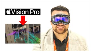
Point Clouds on Apple Vision Pro
Просмотров 5 тыс.4 месяца назад
Join this channel to get access to perks: ruclips.net/channel/UC5eVO8WbTV3FU3-AbtRnl9gjoin Join me on Social Media: 🖥️ Website: www.tamimi.biz 👤 Facebook: tamimibiz 👕 Survey Shirts - www.SurveyShirts.com 👥 Private Facebook Group: groups/iamasurveyor 📸 Instagram: ramitamimi 👔 LinkedIn: www.linkedin.com/in/ramitamimi ✉️ Email: rami@tamimi.biz RCN - ruclips....

DJI Zenmuse L1 vs L2 LiDAR
Просмотров 10 тыс.5 месяцев назад
Register for GeoWeek 2024 before January 19 to get Early Bird Pricing - www.xpressreg.net/register/geow0224/landing.php?sc=RAMI100 More complex project example - ruclips.net/video/-FaUIf6Bwhw/видео.html The L1 has been a solid player since 2020, but it's had its share of quirks, especially with IMU calibration and accuracy issues 🤔. Now, enter the L2 - DJI's latest marvel. It's like stepping in...

How Accurate is Drone LiDAR using DJI Zenmuse L2
Просмотров 35 тыс.6 месяцев назад
🌟 Discover the Power of DJI Zenmuse L2 LiDAR Sensor! 🌐 | In-Depth Mapping with DJI M350 Drone - A Game-Changer in Surveying! 🚁💡 Join The Survey School - thesurveyschool.com/ 🔗 Important Links: DJI Zenmuse L2: enterprise.dji.com/zenmuse-l2 Drone Targets: amzn.to/3Ra5BDw Emlid Reach RS3 GNSS Receiver: store.emlid.com/us/ref/20/ GEOWEEK 2024: www.xpressreg.net/register/geow0224/landing.php?sc=RAMI...

Emlid Reach RX vs RS2+ vs RS3 - Best Value for Your Money?
Просмотров 9 тыс.7 месяцев назад
In today's video, we delve deep into the world of GNSS receivers, comparing the IML Reach RX, RS2 Plus, and the cutting-edge RS3. Our goal? To help you determine the best receiver for your specific needs. 🔗 Important Links: Emlid Store: store.emlid.com/rami 🌐 What You'll Learn: - Understanding GNSS Receivers: We'll explore how these devices use satellites for precise Earth positioning and offer...

Emlid RS3 GNSS: High Precision IMU & Tilt Under $3K! 🚀
Просмотров 9 тыс.7 месяцев назад
Check out the Emlid Reach RS3 - store.emlid.com/rami Join The Survey School - thesurveyschool.com/ Join me on Social Media: 🖥️ Website: www.tamimi.biz 👤 Facebook: tamimibiz 👕 Survey Shirts - www.SurveyShirts.com 👥 Private Facebook Group: groups/iamasurveyor 📸 Instagram: ramitamimi 👔 LinkedIn: www.linkedin.com/in/ramitamimi ✉️ Email: rami@tamimi.biz Explor...
Reality Capture Network 2023 Conference
Просмотров 9197 месяцев назад
realitycapturenetwork.com/ Join me on Social Media: 🖥️ Website: www.tamimi.biz 👤 Facebook: tamimibiz 👕 Survey Shirts - www.SurveyShirts.com 👥 Private Facebook Group: groups/iamasurveyor 📸 Instagram: ramitamimi 👔 LinkedIn: www.linkedin.com/in/ramitamimi ✉️ Email: rami@tamimi.biz #RealityCapture #surveying #lidar
iPhone 15 Pro vs iPhone 14 Pro LiDAR and Camera Accuracy Assessment
Просмотров 31 тыс.8 месяцев назад
iPhone 15 Pro vs iPhone 14 Pro LiDAR and Camera Accuracy Assessment
This is a Full Body LiDAR SLAM Scanner
Просмотров 7 тыс.8 месяцев назад
This is a Full Body LiDAR SLAM Scanner
How LiDAR Mobile Mapping works - Leica TRK
Просмотров 7 тыс.8 месяцев назад
How LiDAR Mobile Mapping works - Leica TRK
DJI just announced the Zenmuse L2 LiDAR sensor
Просмотров 5 тыс.8 месяцев назад
DJI just announced the Zenmuse L2 LiDAR sensor
iPhone 15 Pro LiDAR and Camera vs Survey Total Station Accuracy
Просмотров 147 тыс.8 месяцев назад
iPhone 15 Pro LiDAR and Camera vs Survey Total Station Accuracy
Using my iPhone 15 Pro for Mobile Mapping on an E-Scooter
Просмотров 5 тыс.9 месяцев назад
Using my iPhone 15 Pro for Mobile Mapping on an E-Scooter
Drone Inspection with DJI Mavic 3 Enterprise
Просмотров 24 тыс.Год назад
Drone Inspection with DJI Mavic 3 Enterprise
Leica BLK360 Laser Scanner Review & Accuracy Assessment
Просмотров 32 тыс.Год назад
Leica BLK360 Laser Scanner Review & Accuracy Assessment
Smartphone Mapping with iPhone LiDAR & viDoc RTK
Просмотров 8 тыс.Год назад
Smartphone Mapping with iPhone LiDAR & viDoc RTK
I was on the Reality Capture Network Podcast!
Просмотров 1 тыс.Год назад
I was on the Reality Capture Network Podcast!
Total Station vs. GNSS Receiver: Which is the Better Surveying Tool?
Просмотров 47 тыс.Год назад
Total Station vs. GNSS Receiver: Which is the Better Surveying Tool?
I'm blown away by the Leica GS18I GNSS Receiver
Просмотров 19 тыс.Год назад
I'm blown away by the Leica GS18I GNSS Receiver
How to Survey using Emlid Flow + Giveaway Results
Просмотров 13 тыс.Год назад
How to Survey using Emlid Flow Giveaway Results
Surveying a Lake: A Guide to Collecting and Presenting Drone Data for Clients
Просмотров 13 тыс.Год назад
Surveying a Lake: A Guide to Collecting and Presenting Drone Data for Clients
viDoc RTK: a Surveying GNSS Receiver for your iPhone 14 Pro
Просмотров 22 тыс.Год назад
viDoc RTK: a Surveying GNSS Receiver for your iPhone 14 Pro
GNSS/GPS receiver with Tilt Compensation - Carlson BRx7
Просмотров 17 тыс.Год назад
GNSS/GPS receiver with Tilt Compensation - Carlson BRx7
iPhone 13 Pro vs iPhone 14 Pro - LiDAR and Camera Mapping Accuracy
Просмотров 51 тыс.Год назад
iPhone 13 Pro vs iPhone 14 Pro - LiDAR and Camera Mapping Accuracy
Is there a way to do it with android phone and sparkfun torch instead of emlid?
Why not test some of the devices outside the city, for example in the forest or in some harsh conditions? Try recording a forest road and then compare the accuracy. Many engineers have a need to use this technology to record terrain or existing structures. Thank you
He doesn’t know the difference between, over here and over there. He points to a distant point and says, over here. Local vs distant.
Buy Trimble
How about a veat and some cones...safety first
Now you can clean all that paint off the walk dummy
may we know the specifications of your laptop where you use DJI Terra software. How long did it take for you to process those data for 2D and 3D?
Hi guys, we emailed you to discuss our collaboration.
Pix4D catch 2.0 is much better, especially when paired with a Mavic 3E. Those two make a great pair
Just awesome .Thanks for showing us all these technologies !
Very impressive, timeline excelent
You need to try CHCNAV. It’s a game changer. GPS Signal under tree canopy and next to tall. building. Also has the AR stake out and survey option. Thank me later
Watching you from Red Sea ksa triple bay project
Amazing! I was just in KSA, that’s why my hair is shorter since I just did a Umrah. 🕋🇸🇦
@@RamiTamimi تقبل الله مبروك I hope when next you come we will meet insha Allah respect you from the bottom of my heart ❤️
The accuracy of the PDF digitization to CAD then to AR is awesome. Hard to get things to line up like that the majority of the time. I am really interested in doing this type of stuff but the cost is a big driving factor. It's great to see you promoting things that us small guys can do.
So I did rubber sheet the pdf, but the positions of the structures came from the drone point cloud. The PDFs only served to identify the utility of each structure and the connections happening underground. For $1999, it’s a great price for anyone to get started!
@@RamiTamimi Rami, why isn't everyone upfront? After spending $1999 for the RX and $500 for the Scan Kit, I find out I need to pay $199 a month for a license to use the RTK precision. This is a great tool to have, but there are not enough jobs in a month for a small firm to be able to fork out $199 a month for a tool that may be used only a couple times a month. A daily use fee would be a much better marketing feature for small survey firms. Bad Elf sees that value with the 24 hour pass to activate RTK the engine for precise survey work on the Flex Extreme for $25.
P.S. No RUclips video that has been done to date mentions the $199 a month Pix4D Pro license subscription
yeah, the app is free, but any usefull functions need to be payed for. That AR would work perfectly fine with local files, but no, you need to pay for cloud access that is not needed whatsoever.
nice
Also appreciate the walk around exterior demo. Considering something like that for appraisal work on complex properties.
That is wicked Can you get discrete photos from the images or just screen caps?
We have access to the images too!
Thats very handy been able to see the cad lines for the services while out walking/surveying.
I know, can you imagine how it will be with VR glasses, Apple Vision Pro??
@@RamiTamimi I build/survey fibre networks in Dublin, I can see this technology saving in time and money.
How well does this system work close (say within 1-2m) of the building? And what happens with the point cloud data when RTK FIX is lost? Does the LiDAR still collect points? Thanks.
From other testing I’ve gone on the iPhone, we collect lidar data up to 15 feet (5 meters) away, but of course there’s still imaginary data. As for RTK, even if it’s lost, lidar data is collected and the SLAM algorithms estimate the trajectories of the entire system and help fit the data to be geofrefrenced correctly. Hope this helps!
What's the range of iPhone Lidar?
This video will give you the answer! ruclips.net/video/tk3Y3i3flzs/видео.htmlsi=pjUbbyFIXdzrgtoG
5-6 m.
Great video! However, when the island was surveyed using the iPhone, the measurements likely captured the tops of the plants rather than the actual ground level. This discrepancy is probably the reason for the differences between the two calculated volumes. As a surveyor, you should redo the survey in an area without any plants for a more accurate comparison.
Are you eastinf and northern from points 101 or point to point ? Sorry very new
So for those completely green and new to all this, what are you doing in a nutshell? Measuring elevation for certain area , and placements of all things in the area and where ? What is the purpose you have to be to explain exactly what your doing in the short time in simplest form if you truly know what your doing they say, how long have you been doing seems you have idea what to do but not exactly the true science and purpose of all of it , or could have explained alittle better
What is the point of the placement of the colors and purposes, that might be crucial information correct
The first read ubread 4 and down others u read 4 and above the four which is it ? Im confused
At the begin you gave the opposite way to read js fyi the phil stick ,
Why would you have to do this when you can just measure ? Seems redundant and inaccurate seems pointless, like putting a orange flag arohnd then writing orange tf is going on ?!
I would be glad if you do a teaching on road design.
Interesting ❤❤❤
Great job 👍
Thanks Mom!
So what about 300,000T piles? Will the iPhone work from the ground?
Good Job Man.
بعطيك العافية ياهندسة ربي يبارك في جهدك
Great video! Thanks for it. My questions: 1. Do you need to know the absolute position of the base station before hand (x, y and z) or you can place it anywhere? 2. Do you need to place the base station at the same position for subsequent measurements?
Is there any app for Android
Thank you!
Good stuff if it actually works as intended. In my experience these lidar collection devices only work about 40% of the time you need them to. Keep in mind you'll be processing all this data after collection. If you like sitting at computers, have at it. People I work with see this stuff and say "I didn't sign up to troubleshoot IT problems" or something of that nature. They like things that work solidly all the time.
Poor Bastard Rami being forced to use metric values. The American Engineering Society must have a bounty on him?
Great video, thank you!
i want to join the survey school. but can i get certificate learning after that?
Hey, how r u ? you haven't updated for a long time. We contacted you many times.
What a vid, superb! : )
Your comparisons are always the best. Can you make your ME3 photos available to those of us who know how to do this type of work? I would like to see how close my numbers using WebODM and QGIS would be to yours. Best regards.
How would it work on piles in Bins / bunkers especially when they're lined up adjacent to each other?
Thank you for the effort that you have put into compiling this useful video. Do you use LiDAR x3 for scanning as well or do you only use it for processing?
I use a lot of apps, depends on what the survey is for. LidarX3 does a really good job at stockpile reporting.
Why video uploading was stopped
New video was released yesterday. We are back!
Just a wee note, it’s differential (spelling) leveling
That's it, I'm firing the editor!
Very good work Sir appreciate so much for your teachings Vitus Tanzania
My Pleasure!
hi Rami, love your videos ! Do you think measuring stockpiles with Iphone Lidar is possible inside a dock with low lighting ? with same precisions ?
Lighting doesn't influence the performance of the lidar sensor as it is an active remote sensor, so in theory it should preform the same.
My phone needs light to use the lidar for some reason
Very cool and thanks for sharing. Useful for very small piles, but unfortunately I’ve never seen stockpiles that are small enough like your sample sizes….making a phone capture impossible.
I mean the scale of the pile does matter, for larger piles, drone is definitely the way to go